Antique Map of Virginia and Maryland by John Farrer - circa 1667

by Blue Monocle
Title
Antique Map of Virginia and Maryland by John Farrer - circa 1667
Artist
Blue Monocle
Medium
Drawing - Engraving
Description
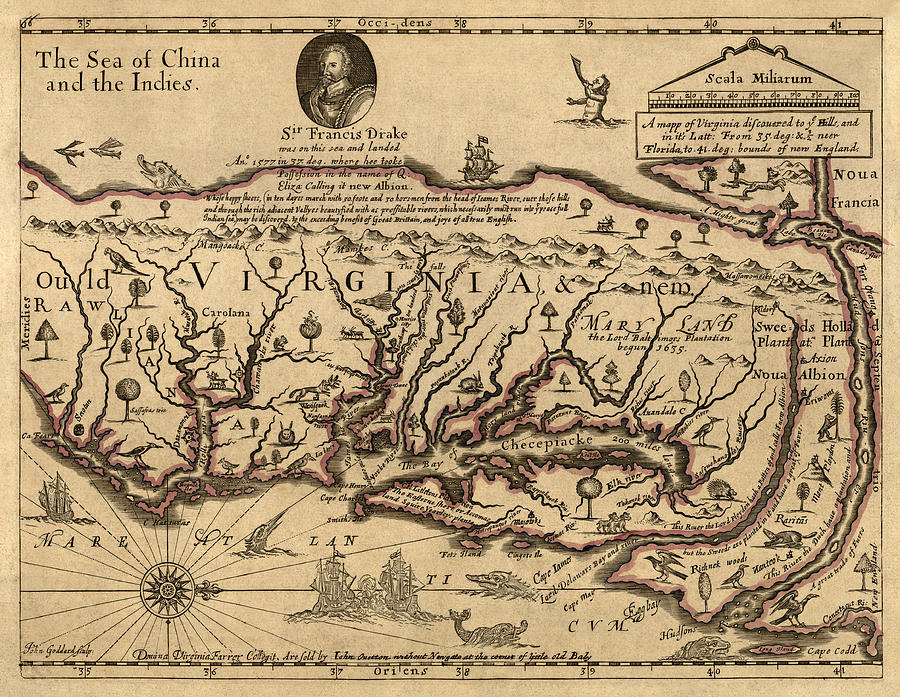
This fanciful map by John Farrer (later amended by his daughter Virginia) shows the mid-Atlantic coast of the United States (with north to the right), focusing on Virginia and Maryland, with the land extending westward only a short ways to the west coast just beyond the Appalachian mountains. The west coast, it was thought, could be reached "...in ten dayes march with 50 foote and 30 horsmen from the head of the Iames (James) River...", beyond which was the "The Sea of China and the Indies", or the Pacific Ocean. The original version of the map showed the long-sought Northwest Passage, connecting the Hudson River to "A Mighty great Lake" that emptied into the Pacific, but on this later version of the map a narrow isthmus blocking the passage has been added. The locations of English, Swedish, and Dutch plantations are shown, and for the first time on a map the name "Carolana" is used. Original title: A Mapp of Virginia Discovered to ye Hills, and in it's Latt. from 35 deg. and 1/2 Neer Florida to 41 deg. Bounds of New England
Uploaded
January 8th, 2014
Statistics
Viewed 1,146 Times - Last Visitor from New York, NY on 04/17/2024 at 12:43 PM
Embed
Share
Sales Sheet
Comments
There are no comments for Antique Map of Virginia and Maryland by John Farrer - circa 1667. Click here to post the first comment.


