Sale on canvas prints! Use code ABCXYZ at checkout for a special discount!

Boundary: Bleed area may not be visible.

Inside Message (Optional)
Inside View

by Blue Monocle
$4.95
Quantity
The more you buy... the more you save.
Orientation
Image Size
Product Details
Our greeting cards are 5" x 7" in size and are produced on digital offset printers using 100 lb. paper stock. Each card is coated with a UV protectant on the outside surface which produces a semi-gloss finish. The inside of each card has a matte white finish and can be customized with your own message up to 500 characters in length. Each card comes with a white envelope for mailing or gift giving.
Design Details
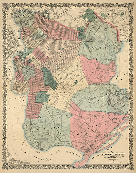
Detailed 19th-century map of Brooklyn and Kings County. Shows the six towns that made up Kings County at the time: New Utrecht, Gravesend, Flatbush,... more
Ships Within
2 - 3 business days
Detailed 19th-century map of Brooklyn and Kings County. Shows the six towns that made up Kings County at the time: New Utrecht, Gravesend, Flatbush, Flatlands, New Lots, and the original town of Brooklyn. Also contains numerous details, including streets, park, cemeteries, rail lines, land ownership, creeks, marshes, and depth soundings in The Narrows and the East River.
Original title: Map of Kings County, N.Y.
Blue Monocle is an imaging studio and print shop specializing in the digital restoration and presentation of antique maps.
$4.95


Andrea Hazel 3 Days Ago
Congratulations
Joseph S Giacalone 4 Days Ago
nice one, congrats
Jeff Brassard
Great job! keep up the good work!