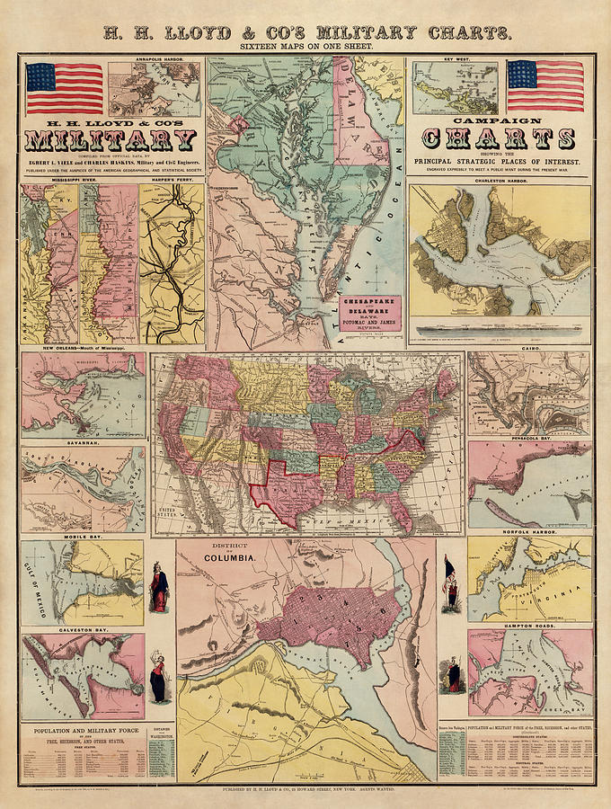
Antique Civil War Map by Egbert L. Viele - circa 1861

by Blue Monocle
Title
Antique Civil War Map by Egbert L. Viele - circa 1861
Artist
Blue Monocle
Medium
Drawing - Engraving
Description
Shows sixteen maps covering places of interest in the early part of the Civil War, generally indicating forts, towns, railroads, and rivers. Shows maps of Annapolis, Key West, the Mississippi River, Chesapeake Bay and vicinity, Charleston, New Orleans, Savannah, Mobile Bay, the United States, Cairo, Pensacola Bay, Galveston Bay, Norfolk, Hampton Roads, Washington, D.C., and Harpers Ferry.
Original title: H. H. Lloyd and Co's. Campaign Military Charts Showing the Principal Strategic Places of Interest
Uploaded
February 14th, 2014
Statistics
Viewed 2,162 Times - Last Visitor from Wilmington, DE on 04/19/2024 at 4:45 AM
Embed
Share
Sales Sheet
Comments
There are no comments for Antique Civil War Map by Egbert L. Viele - circa 1861. Click here to post the first comment.


